Why Old Streets Bend Around the City They Replaced
Learn how to read old streets that bend around earlier paths and building layers, using visible clues to understand why a city resisted a neat grid.
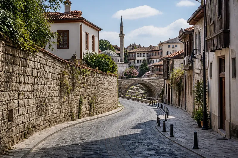
Why do old streets bend instead of meeting in a neat grid? An old street pattern often preserves a route that existed before the present buildings, blocks, or street names. In Eastern cities, successive layers of construction can leave roads following practical lines that a later plan never erased.
You can investigate those lines by walking a short stretch and comparing what you see with a city map. The aim is not to assign every bend a precise age, but to notice where routes change direction, what they connect, and which obstacles or older alignments may explain their shape.
Choose a street with a visible bend
Start with a route that has a kink, curve, or narrowing rather than a long, straight avenue. A short walk between two recognizable intersections is easier to interpret than an entire district, and it gives you a manageable section to compare with a map.
Before setting out, open a current street map and look for a place where parallel streets stop lining up, or where one road takes an oblique course through otherwise regular blocks. An online map helps with orientation; a printed map can make it easier to trace the route without repeatedly shifting the screen.
Choose a public sidewalk or another ordinary pedestrian route, and stay clear of restricted property and traffic. You do not need to enter an alley, courtyard, or building to read the basic pattern. Note where the direction changes and which streets meet the route at those points.
Keep the question narrow: what could account for this particular bend? You are not trying to explain the whole city at once.
Observe the street before explaining it
Walk the stretch in one direction and notice how the street meets its neighbors. Does it continue across several intersections, turn sharply at a corner, or divide into smaller lanes? Does a cross street approach at an unusual angle? These observations describe the present pattern without assuming what came before it.
Look at the edges as well as the road surface. A row of building fronts may follow one alignment, while a wall, property boundary, or narrow passage seems to hold another. A small offset between facing building lines might mark an older lot division or a route that later construction had to work around.
Notice changes in width and pavement, but treat them as clues rather than proof. A narrow section might reflect an inherited lane, a restricted site, or later road alterations. The physical trace gives you a question to investigate, not an answer by itself.
At each turn, stop somewhere safe and look back. A street that seems to end may line up with a passage or road visible from the opposite direction. Write down plain observations such as “the lane bends beside a long wall” or “the cross street meets at an angle.” Descriptions are more useful than early guesses.
Compare current and historic street maps
Return to the map and trace the route you walked. Then compare it with another map if one is readily available: a city planning map, a historic map collection, or an image from a library or municipal archive can show whether the alignment appears across different periods.
Check the map’s date and purpose. A map may show property lines, administrative boundaries, or major roads while leaving minor lanes out. A route missing from one map may still have existed; the map’s scale and subject affect what it records.
Look for continuity rather than expecting an older map to match the modern street exactly. A path may survive as part of a road, shift around a later building, or disappear from the map while leaving a boundary in the present block. If several maps show a route gradually straightening or changing its connections, that may suggest how the street was adapted over time.
Names can help you orient yourself, but a current street name does not establish the route’s age. Focus first on the line itself: its angle, its neighbors, and whether it persists across maps.
Read the street’s shape against the surrounding blocks
Many inherited streets began as connections between places people needed to reach, rather than as parts of a citywide grid. A path might follow relatively level ground, skirt a steep slope, approach a crossing, or connect a settlement to a gate or market area. As buildings gathered along it, the route could become a street without losing its original bends.
Later growth added its own geometry. A new district might be laid out in straighter blocks beside an older lane, leaving the two systems to meet at awkward angles. Rebuilding can preserve property boundaries even as structures change, so the alignment may outlast the buildings that first established it.
Ask what the street seems to link and what it avoids. A road that curves along a hillside may follow the land; one that threads between irregular blocks may reflect parcels fixed before a later redevelopment. These explanations can overlap: terrain shaped a path, and building lines then helped keep it in place.
Do not assume every irregular street is ancient. A bend can also result from later property changes, transport works, or a planned route adjusted to fit a particular site. The strongest reading accounts for several visible clues without claiming more than they support.
Trace a bend through the map layers
Say you choose an invented neighborhood street that turns beside a stone boundary and then points toward an older bridge. On foot, you note the turn, the boundary, and the bridgeward alignment. A historic map then shows a narrow route in roughly the same position, while a later map records larger blocks built around it.
These are the starting observations and comparison steps: follow the present route, record the boundary and direction, then check the corresponding line on maps from different periods. The resulting answer is that an inherited approach route is a plausible explanation for the bend; the tradeoff is that the maps support continuity but do not identify who first used the path or when it formed.
Use the same distinction with a real street. “The road curves toward the river” is an observation; “it follows an old approach path” is an interpretation that needs support from maps or other local records.
Which clues explain a crooked street?
Why might an older street resist a grid?
A grid is easier to impose when land is available for coordinated planning. In an already built area, existing paths, parcels, walls, and routes to important crossings can make a straight layout difficult to fit without removing or rerouting what is there.
Can a street follow the terrain?
Yes. Slopes, waterways, and uneven ground can encourage a route to bend or avoid difficult sections, though the street’s shape may also reflect later building and property lines. Compare the route with the terrain and nearby block edges before choosing an explanation.
Does a crooked street prove it is old?
No. Irregular geometry is a clue, not a date. A street can bend because of later construction or a particular site constraint, so compare maps from different periods and separate visible evidence from a proposed history.
Which map should I consult first?
Begin with a current map to understand the route and its connections, then consult an older map whose date and purpose are clear. A municipal archive or public library may hold useful maps, but their coverage and detail can vary.
Use a street-reading checklist to choose your next claim
For each item, note what you can actually observe, then choose the interpretation that fits. If a clue is absent or unclear, use the alternative rather than filling the gap with a confident origin story.
- Check whether the bend continues across more than one intersection; if it does, treat a persistent route as plausible, but if it stops abruptly, consider a local site constraint instead.
- Check whether a wall or property boundary follows the same line; if it does, consider an inherited parcel edge, but if it does not, look for other explanations such as terrain or later road work.
- Check whether the street points toward a bridge, gate, market, or other clear connection; if it does, consider an approach route, but if no destination aligns, avoid assigning it a historical purpose.
- Check whether a historic map shows a route in roughly the same position; if it does, describe continuity cautiously, but if it does not, check the map’s date and detail before treating the route as absent.
- Check whether later maps show blocks forming around the street; if they do, consider that development may have accommodated an existing alignment, but if the blocks and route appear together, leave their order unresolved.
- Check whether the slope, water, or other terrain feature tracks the curve; if it does, consider a land-shaped route, but if the ground offers no clear constraint, look to parcels, construction, or transport changes.
Build a careful account from the evidence
After comparing the street, its boundaries, and available maps, write a short explanation in layers. State what the route does now, identify any older alignment the maps support, and explain how later blocks may have formed around it. Keep uncertain points open instead of turning a plausible reading into a settled origin story.
If you want more local context, look for city planning records, neighborhood histories, or map collections held by a public library or municipal archive. Use them to clarify what a map records, not to force a tidy story onto every corner. Where evidence is thin, “the bend may preserve an earlier route” is more accurate than a confident claim about its first purpose.
The next time you cross an uneven junction, trace the street’s line beyond the corner before calling it random. Reading an old street pattern carefully means following the connection, comparing its traces, and leaving room for more than one cause.