The Famous Landmark Is Not the Whole Neighborhood
Learn how a famous landmark shapes a neighborhood’s identity, boundaries, and local reputation without standing in for every street or community.
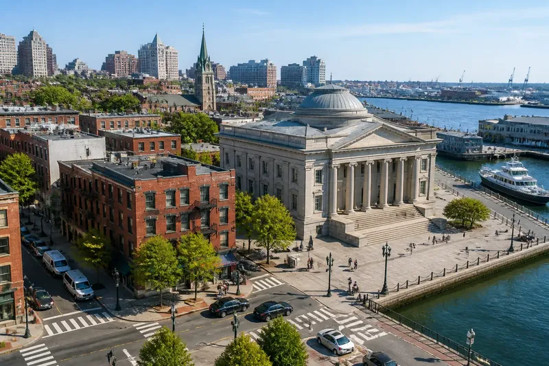
What does a famous landmark tell you about the neighborhood around it? A landmark neighborhood can take its name and public identity from a museum, monument, or station, even when local history and boundaries tell a more layered story.
A landmark can name a place without defining it
A prominent site gives people a shared reference point. It can help a visitor explain where they are, give a neighborhood a recognizable image, or mark a civic center; none of those roles makes it a complete portrait of the district.
Consider the difference between a landmark’s history and the neighborhood’s history. A grand museum may represent one era of civic ambition, while the surrounding streets reflect later building campaigns, migration, commerce, and changes in land use. The museum is part of that story, not its whole timeline.
When describing the area, name the landmark’s actual influence: it may organize a plaza, orient nearby buildings, or lend the district its familiar name. Avoid letting that influence erase other institutions and histories.
How does a landmark acquire a neighborhood’s public identity?
Landmarks are memorable because they are visually distinctive and easy to locate. Maps, visitor materials, and local directions often use them as shorthand, gradually tying a broad area to one recognizable address.
The shorthand can be useful, but it is selective. A district identified with a courthouse, for instance, may also contain places of worship, schools, housing, and commercial corridors that carry their own local significance.
Ask who uses the landmark’s name and for what purpose. A tourism description may use it to orient visitors, while residents may identify with a different street, institution, or neighborhood name.
Landmark neighborhoods have layered boundaries
There may be no single agreed border around an area associated with a famous site. Residents, local organizations, city departments, and mapmakers can draw boundaries for different reasons, and their labels may overlap.
That distinction matters when a location has practical consequences. A service area, planning district, and neighborhood identity are not necessarily the same thing. If you are arranging a meeting or seeking a local service, ask the relevant organization which boundary it uses rather than relying on the landmark’s name.
For a general description, explain the uncertainty plainly: the site is commonly used as a reference point, while nearby blocks may belong to more than one locally recognized area.
Architecture and land use show the landmark’s reach
The relationship between a landmark and its surroundings can be read in the built environment. Look at whether nearby streets converge on an entrance, whether buildings frame a view, or whether the site sits within a larger civic ensemble of plazas, government offices, or cultural institutions.
Then compare those features with the blocks beyond the formal setting. A change in building type or street layout may reveal where the landmark’s planned environment gives way to a different period of development. This is a question of urban form, not a simple line between visitor space and local space.
Old maps, city directories, preservation records, and building plaques can help place those changes in context. Treat each source as a clue with a purpose: a preservation record may describe a structure’s history, while a street map shows how routes and blocks fit together.
Different visitors ask different questions about a landmark district
Is the landmark the historic center of the neighborhood?
Not necessarily. The landmark may have been built after nearby streets were established, or it may have become the district’s public symbol only later. Compare its date and original purpose with the histories of surrounding institutions and buildings.
How can I check a neighborhood boundary?
Start with the organization or city agency whose boundary matters to your purpose. A map can clarify the area it uses, but a neighborhood’s informal identity may extend beyond an official line.
Why do local names differ from map labels?
Maps need consistent labels, while residents may use names shaped by memory, institutions, or everyday speech. Ask what a speaker means by the name instead of treating one version as automatically correct.
What sources help explain a landmark’s surroundings?
Local archives, preservation documents, city directories, and neighborhood histories can each answer different questions. Compare their dates and purposes, and distinguish documented information from interpretation.
A worked example shows how to describe overlapping identities
Imagine you are writing a short description of an invented district called Harbor Square, whose best-known feature is an old customs hall. Your starting information is limited: the hall appears on a visitor map, a neighborhood association calls nearby blocks East Quay, and a city planning map places the hall in a larger waterfront district.
First, you check what each label describes: the visitor map uses the hall to orient visitors, the association names its local area, and the planning map marks a civic boundary. Next, you compare the hall’s location with the association map and see that the hall sits beside, rather than inside, the area the association calls East Quay.
Your resulting description is that Harbor Square’s customs hall is a familiar reference point on the edge of East Quay and within the city’s larger waterfront district. That wording preserves all three identities without claiming that one map settles the neighborhood’s meaning.
Use a short set of checks before describing the area
- Check whether the landmark is inside the named neighborhood or merely nearby; if a local map places it outside, describe it as a reference point at the edge rather than as the neighborhood’s center.
- Check who published the boundary map and what it is for; if it is an official service or planning map, use it for that purpose, but consult a local organization for informal identity.
- Check the landmark’s date against nearby buildings and institutions; if the surrounding places are older or from different periods, describe the district as layered rather than as an extension of the landmark’s era.
- Check whether maps and local sources use different names; if they do, explain which source uses each name and avoid presenting one label as universally accepted.
- Check whether the site’s grounds and approaches continue into the surrounding street pattern; if formal paths stop at a clear edge, distinguish the designed setting from the blocks beyond it.
- Check whether your description attributes a local custom or history to the whole area; if evidence supports only one institution or block, narrow the claim to that place.
These checks help keep a description specific: say what the landmark shapes, what it does not establish, and whose boundary or history you are using.
A neighborhood name can carry more than one meaning
A famous site may lend a district a name, but names also preserve memory, signal belonging, and serve practical needs. A single area can therefore be described differently without every description being mistaken.
For a landmark neighborhood, the clearest account identifies the landmark’s role and names the source of any boundary or historical claim. That precision leaves room for the rest of the district’s institutions and identities—and gives readers a better reason to look beyond the famous address.